
Dutchess County ZIP Code Directory Coverage
County health-planning materials identify the postal places below as serving Dutchess County communities. These are delivery areas, not municipal borders. The postal-place column follows the county mapping, while the notes preserve its cautions about rural areas, shared places, and peripheral map labels. Verify a particular street address with USPS before using a ZIP in a form, records request, or mailing.
| ZIP | Areas Covered | Post Office | Notes |
|---|---|---|---|
| 12501 | Amenia | Amenia | Eastern Dutchess; not the same as the town boundary |
| 12504 | Annandale | Annandale-on-Hudson | Small river postal area; verify exact delivery address |
| 12506 | Bangall | Bangall | Rural, small postal area |
| 12507 | Barrytown | Barrytown | Small river postal area in county materials |
| 12508 | Beacon | Beacon | City ZIP; city and ZIP boundaries are not interchangeable |
| 12510 | Billings | Billings | Small postal place shown in the county table |
| 12511 | Castle Point | Castle Point | Hudson-side community; verify town assumptions |
| 12512 | Chelsea | Chelsea | Wappinger and Hudson-area postal place |
| 12514 | Clinton Corners | Clinton Corners | Clinton-area rural delivery |
| 12522 | Dover Plains | Dover Plains | Dover town has multiple postal places |
| 12524 | Fishkill | Fishkill | Do not equate it with incorporated-place labels |
| 12527 | Glenham | Glenham | Beacon and Fishkill-area community |
| 12531 | Holmes | Holmes | Northern and western edge community |
| 12533 | Hopewell Junction | Hopewell Junction | East Fishkill and central county area |
| 12537 | Hughsonville | Hughsonville | Small postal place |
| 12538 | Hyde Park | Hyde Park | Town has rural and hamlet labels beyond the ZIP |
| 12540 | Lagrangeville / Union Vale | Lagrangeville | One ZIP serves more than one municipal-area label |
| 12545 | Millbrook | Millbrook | Village and town postal place |
| 12546 | Millerton / North East | Millerton | Postal place name does not define the full town |
| 12550 | New Hamburg | New Hamburg | Small Hudson-side postal place |
| 12564 | Pawling | Pawling | Pawling area in county service maps |
| 12567 | Pine Plains | Pine Plains | Northern and eastern rural area |
| 12569 | Pleasant Valley | Pleasant Valley | Central county community |
| 12570 | Poughquag | Poughquag | Beekman and East Fishkill-area postal place |
| 12571 | Red Hook / Milan | Red Hook | Town boundary differs from the village name |
| 12572 | Rhinebeck | Rhinebeck | Rhinebeck area; nearby Rhinecliff has a separate ZIP |
| 12574 | Rhinecliff | Rhinecliff | Small river postal place |
| 12578 | Salt Point | Salt Point | Hyde Park and LaGrange-area rural postal place |
| 12580 | Staatsburg | Staatsburg | Hyde Park-area postal place |
| 12581 | Stanfordville | Stanfordville | Stanford and nearby rural area |
| 12582 | Stormville | Stormville | East Fishkill-area postal place |
| 12583 | Tivoli | Tivoli | ZIP does not describe all of Red Hook town |
| 12585 | Verbank | Verbank | Union Vale and LaGrange rural area |
| 12590 | Wappingers Falls | Wappingers Falls | Includes portions beyond village limits |
| 12592 | Wassaic | Wassaic | Amenia and Dover-area postal place |
| 12594 | Wingdale / Dover | Wingdale | Multiple community labels in the county table |
| 12601 | Poughkeepsie City | Poughkeepsie | City boundary and mailing city can differ at edges |
| 12603 | Poughkeepsie Town | Poughkeepsie | Do not infer city jurisdiction |
| 12604 | Poughkeepsie | Poughkeepsie | Verify whether a specific address is delivery or PO context |
| 10512 | Carmel-area peripheral map label | Carmel, NY | Out-of-county adjacent ZIP, not a Dutchess postal ZIP |
| 10516 | Cold Spring-area peripheral map label | Cold Spring, NY | Adjacent map edge; verify before treating as county coverage |
| 06757 | Kent-area peripheral map label | Kent, CT | Out-of-state map edge, not a New York county ZIP |
Peripheral labels are included only because they appear on the county map context. They are not Dutchess County postal ZIPs. The most dependable count is always address-specific, not a static postal-place list.
Dutchess County Postal Geography
A Dutchess address can carry several labels that answer different questions. The situs or structure address identifies the physical location used by the county map. The tax mailing address is where assessment correspondence goes and can be elsewhere. A County Clerk deed may use a legal description, liber and page, filed map, lot, or metes-and-bounds wording. ParcelAccess uses a SWIS and grid identifier. A postal ZIP and city label is a USPS delivery construct, not a town or city boundary.
This difference is especially important on Dutchess County's rural and river edges. The county warns that its delivery areas do not match municipal boundaries. Postal information can help validate an address, but it does not decide which town maintains a local record, which municipality appears on an assessment roll, or which court or clerk holds a file.
Verify a Dutchess County ZIP
Use the USPS delivery lookup for a current delivery answer. Enter the exact street address, then compare the postal result with the municipality shown by the county GIS or assessment record. This avoids converting a broad postal-place label into a claim about a town boundary. The USPS tool verifies delivery geography, not people or property ownership.
- Enter the complete street address in the USPS delivery lookup and save the returned ZIP.
- Resolve the same structure address in the county Address Info-Finder.
- Compare the reported municipality with the parcel, assessment, or local-office record needed for the question.
- Use the parcel grid, legal description, or recorded document if an older address has changed labels.
USPS delivery lookup is the official exact-address check used for a current Dutchess County ZIP.
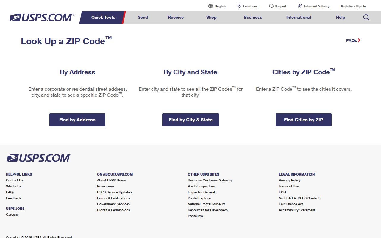
A USPS result should be paired with the county mapping record when the question involves municipal jurisdiction, a parcel, or an older street label.
Dutchess County ZIP Search Fields
Only some official systems capture ZIP as a usable field. The table separates a named-record search from an address tool and a limited public registry. A ZIP result never means that the system has supplied all residents of that area. Each source has its own purpose and access boundary.
| Tool | ZIP-Capable Field | What the Result Means |
|---|---|---|
| USPS delivery lookup | Exact street address to ZIP | Official delivery ZIP for that address, not a resident search |
| NYS Voter Lookup | ZIP with last name, first name, date of birth, and county | Named registered-voter and poll-site context |
| Address Info-Finder | ZIP appears in results; search begins with address and municipality | Resolved structure address, ZIP, and report |
| DOS Licensee Search | County, city, and ZIP fields with name or license type | Licensee search narrowed by licensing location or postal input |
| Comptroller claim search | City and ZIP after the required name or business name | Possible state-held property; proof of identity and entitlement is still required |
| Sex Offender Registry | One selected mode, either county or ZIP | Limited public Level 2 and Level 3 registry record |
For a voter match, the ZIP is only one part of a required named search. For a license or unclaimed-funds result, the postal field narrows an individual or business query. None of these systems is a ZIP-wide people directory.
Dutchess County Parcel Searches Without ZIP
ParcelAccess does not have a captured ZIP input. Its parcel search offers Parcel Lot, Owner Name, and Address modes. Address fields are number, predirectional, street, postdirectional, suffix, and municipality. Owner Name uses last name, first name, and municipality. Parcel Lot uses lot number, SWIS section, block, lot, suffix, and municipality. Search by street and municipality first, then inspect the parcel record rather than assuming a ZIP filter exists.
Dutchess ParcelAccess displays the county search modes used to reach a parcel from an owner, address, or grid.
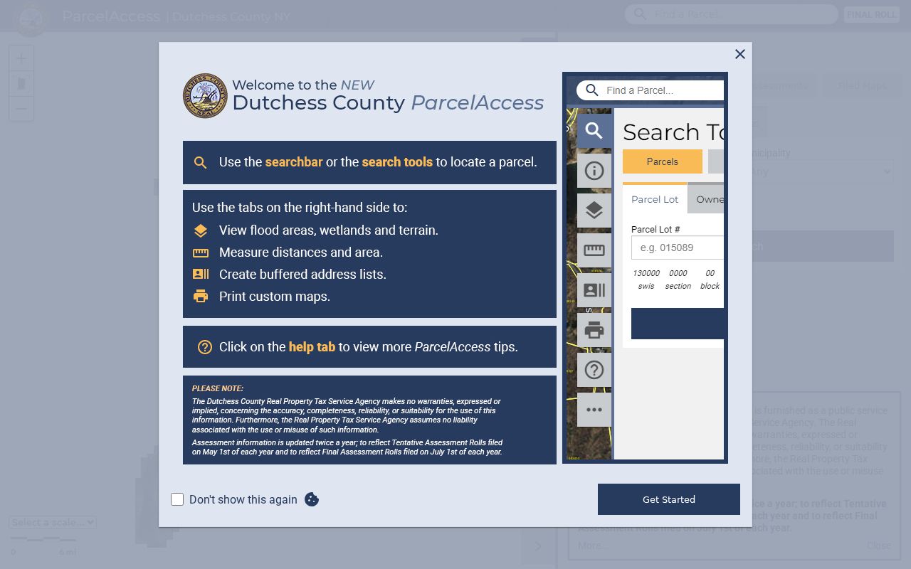
Once a ZIP has narrowed an area, the Dutchess County street directory follows the address and parcel trail in more detail. A parcel card may show an owner and mailing address, but it does not establish current household membership.
Dutchess County Structure Address Results
Address Info-Finder is the county's structure-address tool, not a mailing-address system. Its free and advanced fields are number, predirectional, street, postdirectional, suffix, and municipality. A result gives Address, Municipality, ZIP, and Report. The report centers the map and links to ParcelAccess and public legislative, election, school, and emergency-service information.
Dutchess Address Info-Finder shows the address-first route to a county ZIP result and related local layers.
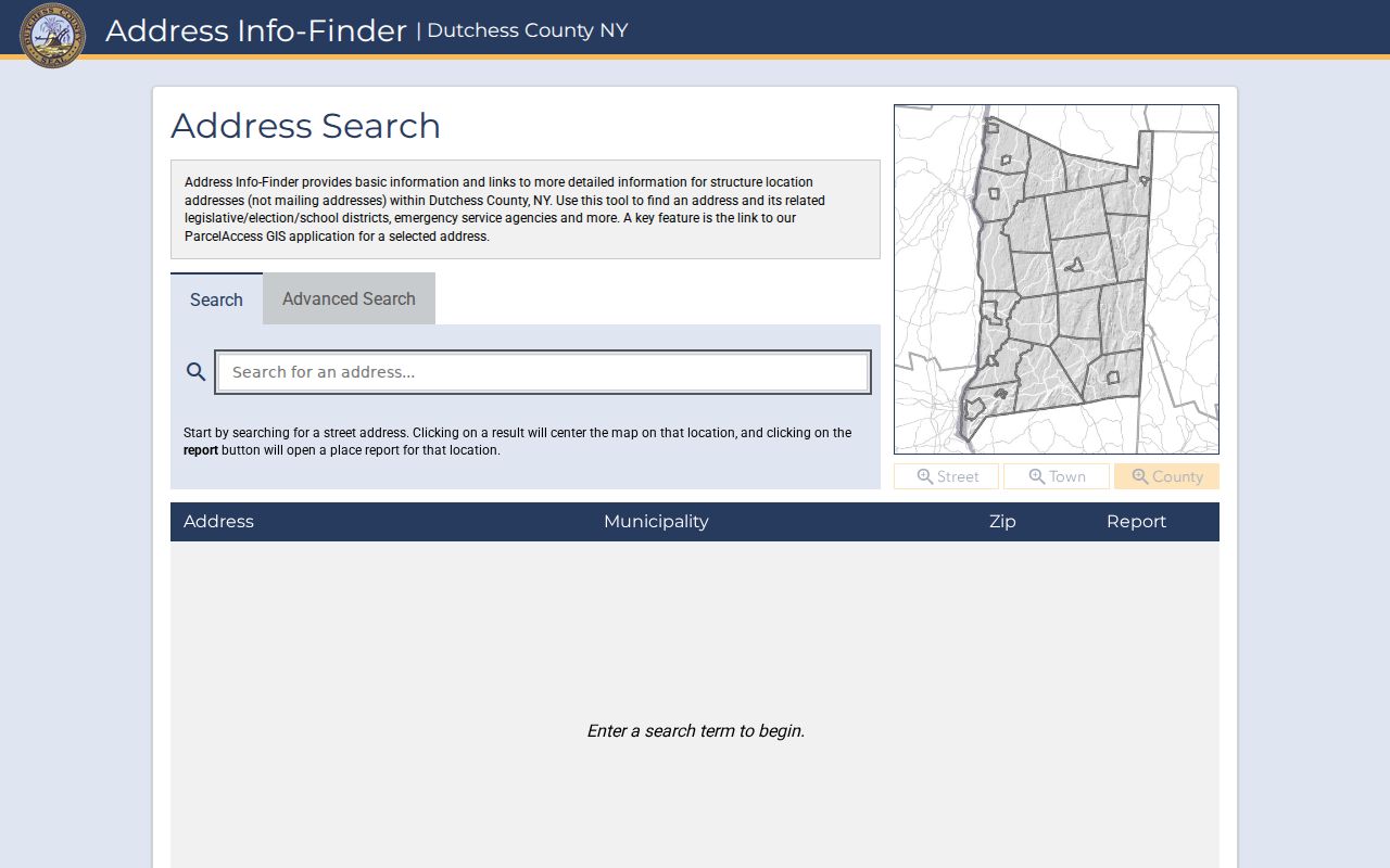
If a postal rendering does not match a parcel, start with the structure report. The missing-address form is a specific fallback and requires street address, municipality, name, and email address.
Dutchess County ZIP Registry Limits
The NYS Sex Offender Registry allows one selected public search mode, including county or ZIP, but it is not a general population search. The public subdirectory is limited to Level 2 and Level 3 records. Its results can include the registry information authorized by law, while Level 1 and undetermined inquiries use a separate phone process with an additional identifier.
The registry search screen illustrates the county-or-ZIP option and its required scope.
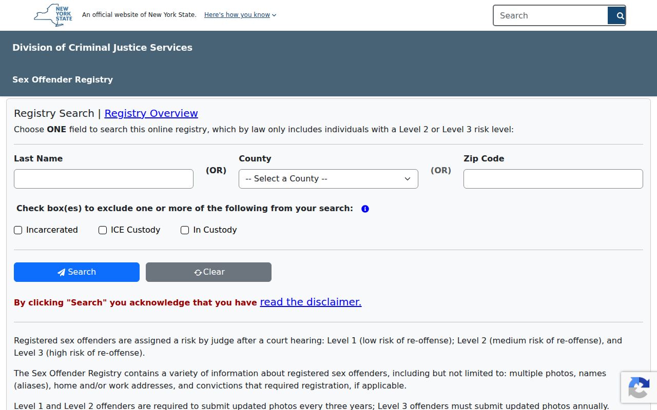
Do not use a ZIP search to construct a broad Dutchess County people list or to infer a complete criminal history. Registry law, risk level, custody status, and update limits control what a result can say.
Dutchess County Records Before Modern ZIPs
Historic Dutchess County directories, deeds, maps, and census records predate modern ZIPs. A nineteenth-century Poughkeepsie, Rhinebeck, village, ward, or street label should not be retrofitted with a current delivery code. For an old address, compare the postal city as written, the directory or newspaper street name, the current USPS answer, the structure address, parcel grid, and legal description. A change in postal wording is not by itself evidence of a move or a sale.
The broader county record story reaches much further back than postal geography. The County Clerk's Ancient Documents project places surviving legal papers from 1721 into the 1840s online, while the MacCracken Index helps bridge surname, year, location, document type, and document number. Those sources can supply historical context, but they are not modern address registers.
Dutchess County ZIP Boundary Mismatches
No official Dutchess-specific ZIP split or realignment chronology was verified in the reviewed sources. Avoid inventing one from an address change. The reliable comparison is current USPS delivery ZIP against the county GIS or assessment municipality, with the parcel and deed trail used to bridge older labels. ZIP boundaries can cross city or town assumptions, and the county map's adjacent New York and Connecticut labels are map-edge context rather than county ZIP coverage.
- ZIP and ZIP+4
- A ZIP identifies a delivery area; ZIP+4 is a more specific delivery segment attached to an address.
- PO-box ZIP
- A postal code used for a post-office box context, which still requires an exact-address or postal verification when relevant.
- Unique ZIP
- A ZIP assigned to a single delivery context or organization, not a way to identify a municipality.
- Carrier route
- A delivery route within postal operations, which does not set a town boundary or public-record jurisdiction.