
Search Dutchess Streets by Address
A Dutchess street directory search begins with an address, not an assumed resident name. The county’s address and parcel tools establish the structure, municipality, ZIP result, and parcel grid. From there, the assessed-owner panel and County Clerk records form an ownership trail. A known-person voter query and a dated reverse directory serve different, narrower purposes. They can support a match, but neither supplies a current household roster. Streets can cross municipal boundaries, use more than one ZIP, and carry a mailing city that is not the governmental municipality. Record the municipality and grid with every result.
- Enter the structure address in Address Info-Finder and save its municipality, ZIP result, report, and parcel link.
- Open ParcelAccess, compare the location with the parcel panel, and record the grid, assessed owner, mailing address, land use, and assessment date.
- Search the current owner as a party or grantee in the County Clerk document index. Use the deed’s legal description, map, lot, and prior reference to confirm the parcel.
- For a known person, use the state voter form only with the required name, date of birth, county, and ZIP or address context. It is not a street-wide search.
- For older address evidence, check an applicable reverse or criss-cross directory at DCHS or PPLD Main & Market, then confirm the volume’s locality and year.
Ownership and occupancy should stay separate in the notes. A deed or parcel card may identify an owner, while a historical directory can place a person at an address for its publication year.
Use Dutchess Address Info-Finder
Address Info-Finder is the right first stop when a postal-style address does not resolve in the property search. It is a structure-address tool, not a mailing-address directory. A free query or the advanced Number, Predir, Street, Postdir, Suffix, and Municipality fields returns an address, municipality, ZIP, and report. The report links to ParcelAccess and public legislative, election, school, and emergency-service layers. Its missing-address form requires a street address, municipality, requester name, and email, so it is a correction route rather than a lookup shortcut.
The Dutchess Address Info-Finder screen shows the structure-search and report path used for this first address check.
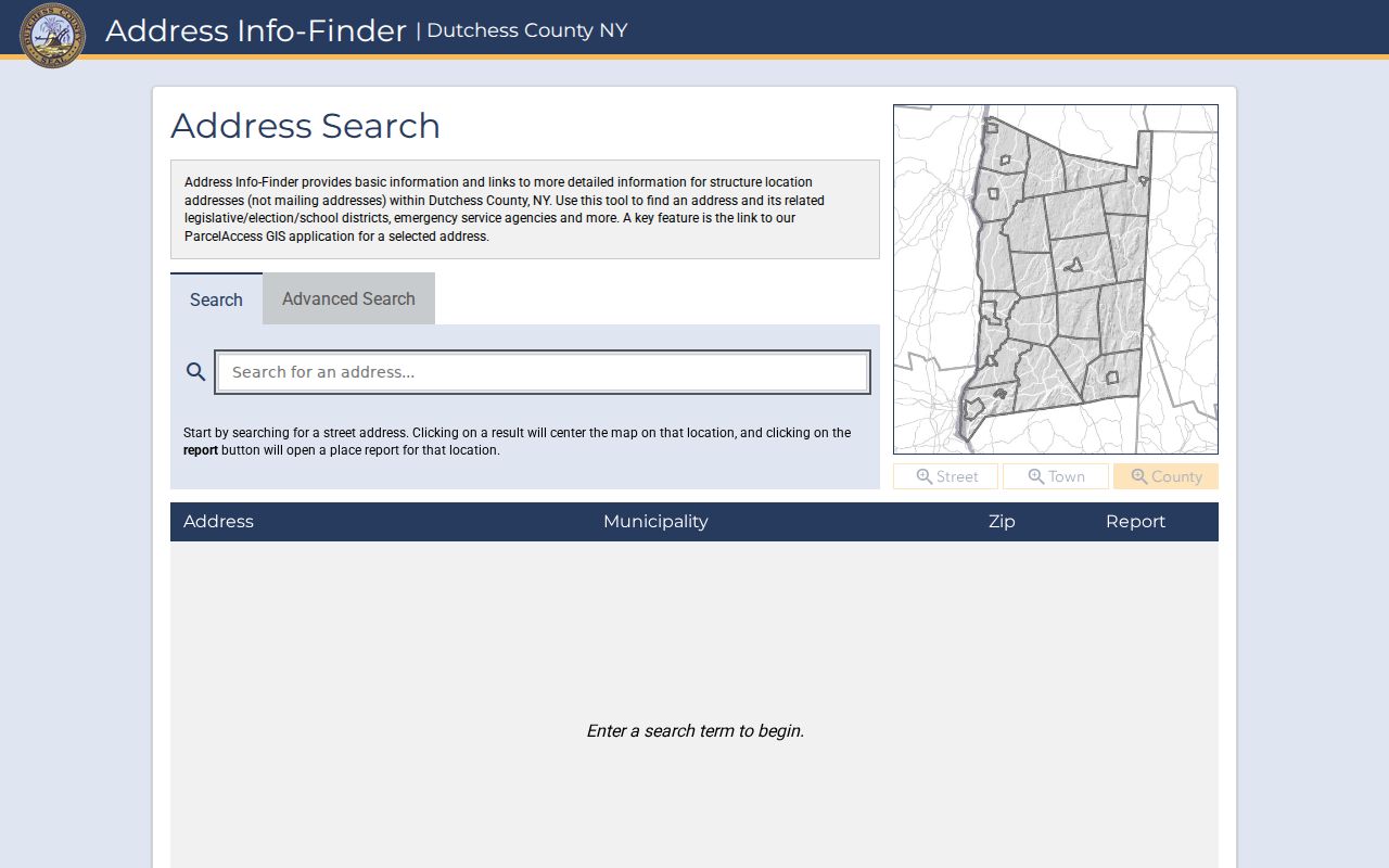
Use the report to preserve the county’s structure rendering before comparing it with a parcel mailing address or a deed’s legal description.
Note: Save the query date because district boundaries and assessment information can change after the report is generated.
Read Dutchess ParcelAccess Fields
Dutchess ParcelAccess offers Parcel Lot, Owner Name, and Address search modes, plus Parcels, Sales, Assessments, and Filed Maps tools or layers. An address search accepts Number, Predir, Street, Postdir, Suffix, and Municipality. Municipality is especially useful when a street name recurs around the county or the first result set is too large to display. The owner panel exposes the parcel number, associated grids or lease codes, parcel location, municipality, owner name, primary owner mailing address, lot size, land use, assessment, market value, and school district.
| ParcelAccess field | How to use it on a street |
|---|---|
| Number and Street | Enter the physical street number and name, then narrow with the municipality. |
| Predir, Postdir, and Suffix | Match directional and street-type formatting when the initial address is not found. |
| Owner Name | Use last name, first name, and municipality after a parcel has identified a likely owner. |
| Parcel Lot and grid | Use the SWIS-style parcel identity, map, and lot when addresses are shared or ambiguous. |
| Map and layer controls | Browse parcels, sales, assessments, and filed maps, then select a parcel for details. |
The ParcelAccess search interface displays the address, owner, parcel-lot, and map modes described above.
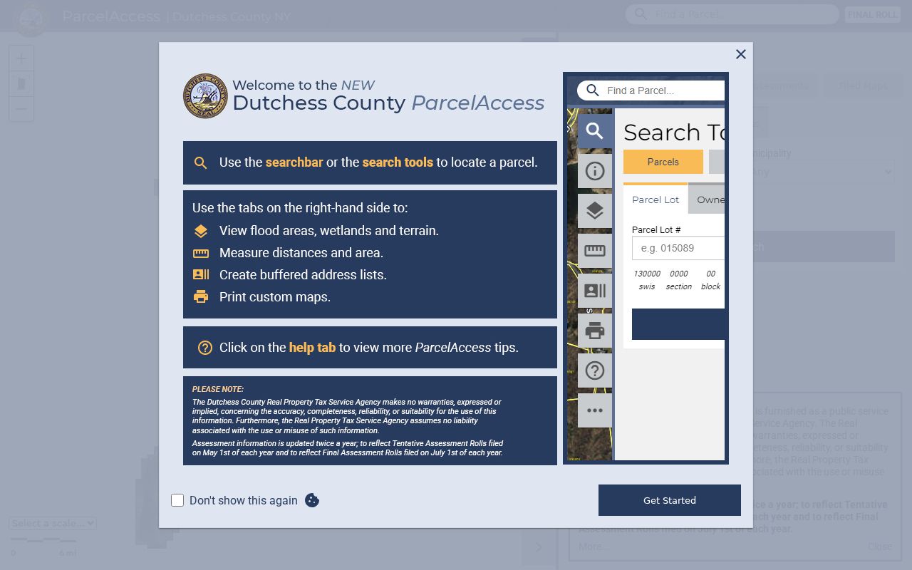
A result is a property record, not proof that the listed owner currently occupies the structure. The primary mailing address can be off-site, can belong to a tax agent, or can reflect the roll cycle.
- Parcel
- A mapped unit of real property used for assessment and tax administration.
- Situs address
- The physical structure or parcel location, which can differ from the tax mailing address.
- SWIS or grid
- A county parcel identifier that helps distinguish lots with similar street addresses.
- Filed map
- A recorded map that ties lots and subdivision layout to the legal parcel description.
- Criss-cross directory
- A historical directory arranged by address so a reader can look for an occupant or business at a location.
Browse a Dutchess Street Manually
For a long road, use a municipality-first, street-second approach. ParcelAccess can cap an oversized list or map result, so refine with a street number or return to Address Info-Finder. Then zoom the map, select parcels one at a time, and compare the parcel location with the primary mailing address. The parcel viewer is useful for placing properties in sequence, but it is not an automated whole-street export. A road can enter another town, and a postal ZIP does not determine the municipal record keeper.
The ParcelAccess viewer illustrates the mapped parcel panel and the owner, mailing, land-use, assessment, and value fields available for an individual result.
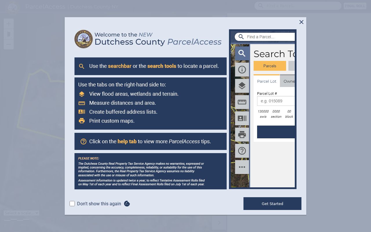
Use a parcel’s location and grid as the reliable anchor when the mailing city, street suffix, or ZIP presentation differs across sources.
Trace Dutchess Street Deeds
The County Clerk Document Search indexes parties and legal records rather than a simple street-address list. After finding the assessed owner, search that person as a grantee or party, then use the deed’s legal description, filed map, lot, liber and page, municipality, or prior instrument reference to verify the correct property. A grantor is the party transferring an interest; a grantee is the party receiving it. Search the prior grantor as grantee to move backward through the chain. A mortgage, judgment, Lis Pendens, or tax sale has a different meaning from a deed and should not be treated as an ownership transfer.
The County Clerk deed-index form supports party-name, recorded-date, document year and number, liber and page, document-type, and image controls.
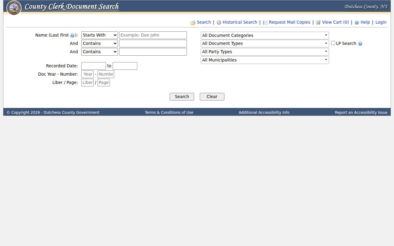
The public application contains more than 1.3 million land and legal document images. Online viewing is free. An unwatermarked download or print is listed at $0.50 per page, and certified copies come through the Record Room. The historical index reaches 1718 to 1989, while the sources differ slightly on the earliest online deed-image date, so use the portal’s displayed Liber 355 cutoff and ask the Record Room to verify the book when it matters.
Dutchess Street Directory Sources
Address-keyed records answer different questions. Link the sources through the parcel grid or legal description, not merely a similar street name. The County Clerk, Real Property Tax Service Agency, municipal assessors, and city or town departments each hold a separate portion of the record trail. Where no countywide online index was located, the documented fallback is the responsible municipal department or a FOIL request, not an assumption that the record does not exist.
| Address record | What it can establish | Access route |
|---|---|---|
| Address Info-Finder | Structure address, municipality, ZIP result, district report, and parcel link. | Free county address search. |
| ParcelAccess and assessment rolls | Parcel grid, assessed owner, mailing address, land use, value, and exemptions. | Free map or municipality-specific roll PDF. |
| County Clerk deed index | Parties, document type, record date, legal description, and map or lot references. | Free viewing; paid unwatermarked image or Record Room copy. |
| Filed and tax maps | Lot relationships, road layout, and subdivision mapping. | Parcel map layer, downloadable municipal tax maps, or clerk and agency copies. |
| Municipal permit or code record | Addressed work, applicant or owner, contractor, and inspection or status when retained. | Request the relevant city or town department or use FOIL. |
| Historical reverse directory | Dated address-to-occupant or business context where a volume includes that section. | DCHS or PPLD collections, with year and geography checked first. |
A parcel number can connect an assessment roll to a filed map. A deed’s legal description can then confirm the same real property even when its street wording changes.
Dutchess Street Permits and Voters
Municipal permits can add address-based context, but no countywide searchable permit-case index was located. Beacon publishes forms for building, code enforcement, electrical, driveway, excavation or grading, fire safety, floodplain, HVAC, lot-line, plumbing, sidewalk, sign, and vacant-building matters. Those forms show that records may be held locally. Ask the relevant city or town office for a permit number, issue date, applicant or owner, project description, inspection or final status, and retained plans, subject to FOIL exemptions and copying charges.
The Beacon permits and forms page is an example of the municipal route. It does not provide a verified online case search for every address or every Dutchess municipality.
Likewise, the NYS Voter Lookup is a known-person match and poll-site utility. It requires county, last name, first name, date of birth, and ZIP or address context. It cannot be used to produce everyone on a street. A voter-file request requires the Election Law §3-103(5) elections-purpose statement, and confidential registrations under §5-508 are not available for ordinary inspection.
The New York voter lookup form shows the individual fields required for a registered-voter match.
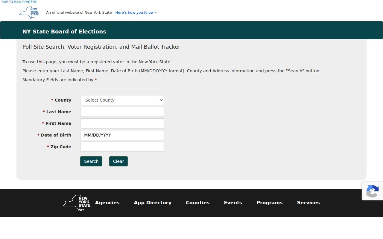
A result may indicate a registered voting address and poll-site context. It does not establish current physical occupancy, ballot choices, or other household members.
Note: Confirm the request format and available fields with the Dutchess Board of Elections before seeking any voter file.
Map Dutchess Street Parcels
When a street number covers several lots or a road bends around a subdivision, filed maps and the grid are stronger than a guess. The Parcel History route can search by municipality, name, location number, location address, lot, sub lot, parcel grid, filed map number, or filed lot number. Its results include the SWIS, grid number, location address, owner name, map number, lot number, and acres. County tax maps are downloadable by municipality, and zoning or aerial layers can help explain road layout or the development context. They do not identify private household members.
The Parcel History sample shows the grid, location, owner, map, lot, and acreage fields that help keep neighboring or same-number parcels distinct.
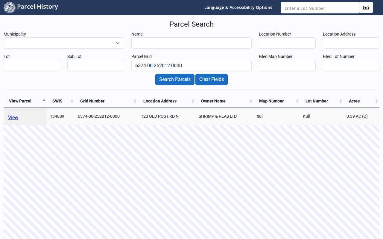
The map and lot fields are the bridge between a physical street location and a deed that may omit the street number.
Read Old Dutchess Street Entries
For an older address, a reverse or criss-cross directory can supply a dated occupant or business clue. DCHS catalog rows identify Poughkeepsie directories for 1867 to 1868, 1871 to 1873, 1897, and 1928, as well as a 1895 to 1896 Dutchess County Directory and a 1899 to 1900 Hudson River Railroad directory. PPLD’s Main & Market collection adds digitized city-directory and local-resident material. Search both the alphabetic and address sections when the volume has them, then inspect the title page to learn whether it covers a city, town, business district, or wider county.
Do not retrofit a modern ZIP onto an old printed entry. Historic address evidence is strongest when it is paired with the directory year, municipal label, parcel or map reference, and an independent source such as a deed, assessment roll, census, or newspaper.
For a sustained historical-shelf search, the Dutchess city directory page focuses on the local collections rather than the current address chain.
Dutchess Street Names and ZIPs
Dutchess records use several address systems. Address Info-Finder uses the physical structure location. The assessment mailing address is for tax correspondence. A deed may rely on a legal description, liber and page, filed map, and lot. ParcelAccess uses a grid, while a ZIP and mailing city are postal constructs. Those systems can legitimately disagree. For example, the county warns that ZIP labels do not define town boundaries, and a street can cross municipal lines or have more than one postal presentation.
No verified countywide street-renumbering or renaming chronology was located in the official sources. If an older number fails, compare the old street name, legal description, adjacent owner, filed map, newspaper, Sanborn sheet, and municipality-specific clerk records. Do not assume a changed postal label proves a move or sale.
Limits of Dutchess Street Searches
A street directory can identify public parcel and record routes, not every person connected with an address. Renters and household members may not appear in owner records. An unregistered voter is not a voter-record match. A protected voter or Address Confidentiality Program participant can have an intentionally withheld or substitute address. DMV information is restricted by federal law, utility and delivery records are not public address tools, and a deed can be stale as evidence of current occupancy. A no-result may mean the source lacks the relevant date, geography, or index field.
Lawful use. Use Dutchess street records for personal, lawful research, family history, property questions, or civic understanding. Never use an address trail to watch, harass, intimidate, or expose a protected person.
County and state sources treat a missing or mismatched address as a possible protection or records-boundary issue. Treat that limit as intentional unless the custodian can correct a specific record.