
Find Dutchess Neighbors by Block
Different records answer different questions about a Dutchess block. ParcelAccess gives the mapped parcel, current assessed owner, primary owner mailing address, land use, and value fields. Address Info-Finder places a structure in a municipality and links it to the parcel and district report. A deed can establish a recorded transfer, while an assessment or tax roll is tied to its own roll date. The state voter form is only for a known person, not a block roster. Local associations and library sources are orientation and history leads, not proof that somebody lives at an address.
| Source | What it shows about a block | Access |
|---|---|---|
| ParcelAccess map | Parcel lines, grid numbers, owner and mailing address, land use, and value. | Public map with manual click and browse, not an automatic neighbor list. |
| Address Info-Finder | Structure address, municipality, ZIP result, and linked district report. | Public address search; it is not a mailing-address tool. |
| Assessment and tax rolls | Owners or taxpayers, parcel IDs, exemptions, and values for a municipality. | Public municipal PDFs with roll-date lag. |
| County Clerk deed index | Recorded parties and transfers for a parcel. | Public index and image workflow; legal-description matching is required. |
| Municipal permit or code files | Addressed building work and retained applicant, contractor, or status records. | Responsible department request or FOIL; no countywide online case index located. |
| Historic directories and local collections | Older occupants, business, club, and local-history clues. | PPLD or DCHS holdings; year and geography vary by item. |
A listed owner is not necessarily an occupant, and an off-site tax mailing address can be valid. Keep each source’s date and purpose beside the result.
Open a Dutchess Target Parcel
Begin with the county’s Address Info-Finder when the search starts from a street address. It searches the structure location using a free query or advanced Number, Predir, Street, Postdir, Suffix, and Municipality fields. The result reports the address, municipality, ZIP, and a link to ParcelAccess. That link is useful because a postal rendering may not match the parcel application, and a county street can pass through different municipal or ZIP labels.
The Dutchess Address Info-Finder screen shows the structure-address fields and report route that lead into the parcel map.
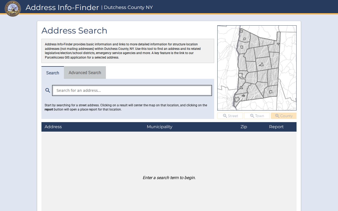
The report gives a consistent starting point before nearby parcels, tax mail, or district information are compared.
Map Dutchess Neighbor Parcels
The Dutchess GIS workflow is map-first and manual. No verified radius, buffer, one-click adjacent-parcel tool, or automatic neighbor export was located in the official interface material. Open the target’s report and ParcelAccess link, zoom to the parcel, and use the visible parcel boundaries and labels to identify adjoining grid numbers. Then open each surrounding parcel detail separately. A location that looks close by street number or ZIP can be separated by a road, stream, unbuildable strip, shared driveway, or municipal boundary.
- Resolve the target structure in Address Info-Finder and open its linked ParcelAccess result.
- Zoom to the parcel boundary, note the grid or SWIS identifier and municipality, then identify physically adjoining parcel labels.
- Select one adjacent parcel at a time and record its grid, location address, owner, primary mailing address, filed map or lot, land use, and assessment date.
- Use the deed index or assessment roll to check a particular parcel when the map, legal description, or roll date needs confirmation.
- Use filed maps, tax maps, zoning, and aerial layers to understand the physical block, not to infer private household data.
The ParcelAccess viewer displays the individual parcel fields that make this manual comparison possible.
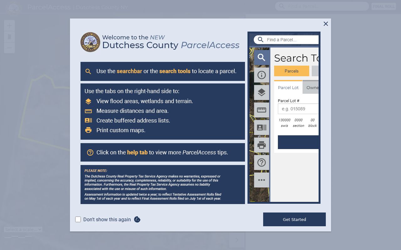
Manual selection keeps the result tied to actual parcel boundaries instead of an unreliable list based on a street or ZIP label.
Note: Record the municipality with each grid number because a nearby parcel can fall under a different local assessor or department.
Compare Dutchess Neighbor Fields
ParcelAccess shows a parcel number, associated grid numbers or lease codes, parcel location, municipality, owner, primary owner mailing address, lot size, land use, assessment, market value, and school district. These fields do not all mean the same thing. The parcel location is the physical site. The mailing address tells the county where it sends assessment or tax correspondence. Land use describes the parcel classification, and the assessment reflects the roll’s timing. A current owner record can still lag a transfer that occurred after the roll date.
The Parcel History sample shows the SWIS, grid number, location address, owner, map number, lot number, and acreage fields available as an alternate route when the map search needs more narrowing.
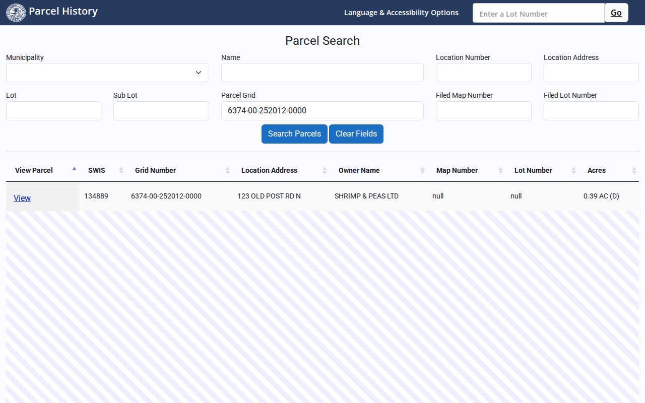
Compare the location address, grid, and map or lot before assuming two similarly numbered properties are the same place.
- Parcel grid
- A county property identifier that anchors the map, assessment, and filed-map record.
- Situs or location address
- The physical parcel or structure address, which may differ from a mailing address.
- Primary owner mailing address
- The address used for tax correspondence, not evidence that the owner lives at the parcel.
- Filed map and lot
- Recorded land-reference fields that help distinguish subdivisions and adjoining parcels.
Check Dutchess Neighbor Records
Official sources reveal a limited, dated property trail. ParcelAccess can be checked against a municipal assessment or tax roll, then against the County Clerk deed index when ownership needs confirmation. A municipal building or code office may retain address-specific files, but no countywide searchable permit index was located. Request the relevant local department for a permit number, issue date, applicant or owner, project description, inspection or final status, and retained plans, subject to the record’s available access and FOIL exemptions.
| Official record chain | Commercial neighbor-lookup category |
|---|---|
| Identifies a public custodian, parcel, legal record, roll date, and access limit. | Can combine public and purchased data without showing a reliable parcel or record-date chain. |
| Lets a reader compare an owner, situs, mailing address, grid, and deed description separately. | Can duplicate addresses, conflate similar names, or retain stale connections. |
| Uses map, clerk, library, and civic sources for a specific question. | Does not turn private household members into verified public records. |
For a whole named road rather than its immediate adjoining parcels, use the Dutchess street directory workflow, which follows address records along the street.
Dutchess Neighbor Voter Limits
The NYS Voter Lookup is not a way to search every household around a block. It asks for county, last name, first name, date of birth, and ZIP or address context to check a known registered voter and provide poll-site context. It does not promise a household roster, full date of birth, voter ID, or ballot choices. A non-match may reflect spelling, an address change, inactive status, confidential registration, or the data’s timing rather than a conclusion about a person.
Voter-registration data requests require an elections-purpose statement under Election Law §3-103(5). Confidential registrations under §5-508 are held separately and are unavailable for ordinary inspection or copying. The Address Confidentiality Program can also produce a protected or substitute address. A voter-record match may indicate a registration address, but it should not be treated as proof of current presence on the block.
Dutchess Neighbor Associations
County-listed associations and civic facilities help identify community contacts, events, or local-history leads. They are not verified membership directories. The county’s public chamber and business-association list includes Arlington BID, Beacon Chamber of Commerce, Clinton Business Association, Dover-Wingdale Chamber, Dutchess County Regional Chamber, Fishkill Business Association, Harlem Valley Chamber or Partnership, Hyde Park Chamber, Millbrook, Pawling, Pine Plains, Red Hook, Rhinebeck, and Wappingers Falls groups. Current household rosters were not located in the official sources.
| Association or facility | Area or role | Public-use boundary |
|---|---|---|
| Arlington Business Improvement District | Arlington and Poughkeepsie business district | Public community organization lead, not a household roster. |
| Beacon Chamber of Commerce | Beacon business and civic network | Use public contacts and events, not an assumed resident list. |
| Dutchess County Regional Chamber | Countywide business network | Umbrella chamber that may identify business contacts, not private homes. |
| Holmes Whaley Lake Civic Association | Civic facility named in a 2025 Dutchess poll-site notice | Verified association lead; no membership directory was located. |
| City or town clubs, congregations, and block-watch groups | Local community layer | Ask the organization directly and respect its private membership rules. |
The Dutchess community-association directory is the public orientation source for these networks.
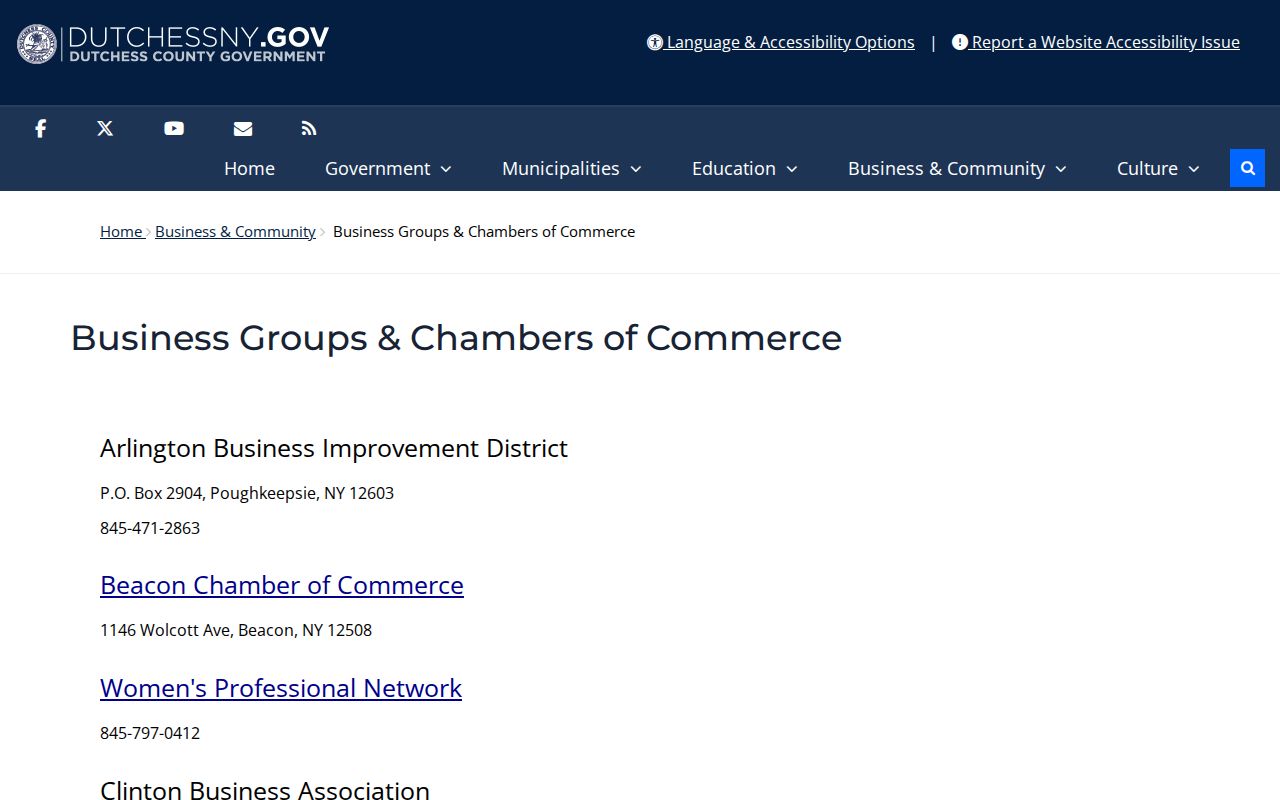
Public organization listings can locate a community resource, but they do not establish that a person owns or lives at a nearby parcel.
Dutchess Blocks Cross Boundaries
Dutchess County has two cities, Beacon and Poughkeepsie, 20 towns, and villages and hamlets. That local scale matters when a block touches a municipal edge or uses a postal label that differs from its record jurisdiction. County geography also varies from denser river-city blocks to rural roads where parcel grids, tax maps, churches, and county-directory evidence may be more useful than a city address listing. The municipality and parcel grid are therefore more dependable than a ZIP or mailing-city assumption.
Postal labels can span more than one municipal area. County materials note that Red Hook and Milan share ZIP 12571, Lagrangeville and Union Vale share 12540, and Wingdale and Dover share 12594. Those examples explain why a map review should come before any conclusion about which local records office holds an address-based file.
Note: Use the physical parcel boundary, not a ZIP or street-number sequence, to decide which properties actually adjoin the target.
Privacy Limits for Dutchess Neighbors
Block research has deliberate limits. Renters and household members may not appear in public owner records. Protected voters and Address Confidentiality Program participants can have a substitute or withheld address. DMV data, utility accounts, delivery records, and sealed court or vital records are not open block-lookup tools. Even a public parcel owner is not a complete answer about who is presently at a property. The sound result is a record path for adjoining public parcels, not a published list of private residents.
Lawful use. Use Dutchess neighbor records for personal, lawful research, community orientation, property questions, or family history. Never use them to monitor, harass, intimidate, or expose a protected person.
A missing address, a mailing mismatch, or a non-match can be a valid privacy or records-boundary outcome. Keep the underlying public record narrow and respect that boundary.